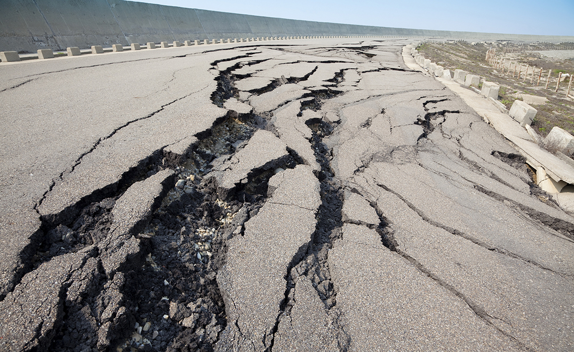
From ancient times to the present, strong and catastrophic quakes have caused tremendous destruction in the territory of Azerbaijan. Many earthquakes occur every year, though the majority are not felt. Azerbaijan includes several seismically active regions – for example the Caspian Sea, the Southern Talysh Mountains, Ganja-Dashkasan and the Shamakhi-Ismayilli and Shaki-Zagatala regions. But it’s not only the country’s geology that makes it vulnerable: a dense population and dense oil infrastructure mean that earthquakes have the potential to bring high economic and human costs.
“High-speed Internet is essential in order to process information about earthquakes in Azerbaijan and neighbouring countries,” says Ruqiyya Karimova. She is actively involved in earthquake research as a system administrator at Azerbaijan’s Earthquake Research Bureau of the Republican Seismic Survey Center (RSSC), which relies on the national research and education network AzScienceNet to provide connectivity and services through the EU-funded EaPConnect project. “AzScienceNet’s collaboration with RSSC and GÉANT through EapConnect has improved our work a lot.”
Why is Azerbaijan vulnerable?
The territory of Azerbaijan is located in the central part of the ‘Mediterranean mobile belt’ and is characterised by high geological activity that is due to the dynamics of the Arabian and Eurasian lithospheric plates. As the Alpine-Himalayan seismic belt passes through Azerbaijan, seismogenic zones with the potential to create a dangerous force cover the entire country.
What measures have been taken?
The RSSC has a network of seismic stations, which detects 10-20 tremors every day, sometimes 100, with 0.1 magnitudes, says Ruqiyya Karimova. In 2019, on 5-6 February, tremors were recorded with an earthquake of six points at the epicentre, and of 3-5 points in the surrounding areas. Approximately 1000 aftershocks were detected.
“Located in a seismically active zone, Azerbaijan places a special emphasis on the development of seismic experience and the installation of seismic stations. 35 seismic stations are established in Azerbaijan with the leading station in the academic town of Baku. All stations are connected to the satellite system. These stations allow us to receive information regularly from vibration sensors that are installed in seismically active sites in Azerbaijan. After processing data, these stations allow us to detect each earthquake’s time, location and strength. Following the earthquake in Baku in 2000, we got the most up-to-date equipment, including mobile seismic stations, geo-physics stations and GPS stations,” says Ruqiyya Karimova.
“These stations explore the seismic regime of the Republic’s territory, the distribution of earthquake epicentres, the dynamics of seismic processes in the epicentres, identify the active parts of depth fractures and the intensity of the potentially most powerful earthquakes. The information is logged directly into our monitoring network. The Antelope program is currently most active in processing data from those stations. It is also planned to install an additional five stations on land.”
Seismological organisations all over the world send information about earthquakes of a magnitude greater than 3 to the European-Mediterranean Seismological Centre. Tremors below 3 are used exclusively for research. It is impossible to predict earthquakes in advance. The most advanced technology in this area is in Japan and the United States. Although data is now controlled from space, tremors cannot even be detected from space.
As the monitoring network is expanding, the quality of the data is improving. Three offshore seismic stations were purchased to be placed on oil-field platforms (Umid, Bahar and Gunashli) in the Azerbaijani sector of the Caspian Sea. The most earthquakes occur in the Caspian Sea, so this will help make it possible to learn more about the seabed processes. Devices for the 5 new land stations were purchased and locations identified.
What kind of challenges do you face in your job?
“There are problems if outage happens on the Internet for even 20-30 seconds. When an earthquake occurs, we process the information within 5 to 10 minutes and send it to the required structures immediately – the Cabinet of Ministers, the Presidential Office etc. Consequently, uninterrupted Internet service is very essential in our work.”
Role of AzScienceNet
Information about earthquakes in Azerbaijan and from around the world is continuously processed at the Earthquake Research Bureau. All data undergo various types of measurements at the RSSC, and then are used to predict areas of high seismic activity. For this reason, AzScienceNet provides the bureau with continuous high-speed Internet and computing resources. The RSSC also uses storage resources in a volume of 13 terabytes for archiving all data and logs.
The Big Data archive, which was collected for a long time at the Earthquake Research Bureau, has been stored in the AzScienceNet Data Center. The archive consists of registration data of all tectonic movements occurring in Azerbaijan in 2003-2018. This includes earthquake magnitudes, waveforms, intensity, space and time. Deployment of the Bureau’s archive to the Data Center plays an important role in preventing adverse circumstances such as lack of storage, loss of data and so on, says Ruqiyya.
“Whenever problems arise, AzScienceNet employees help us immediately,” says Ruqiyya. “the need is growing to use Big Data technology to store data on a more reliable server and to process data quickly as a result of the increase in the volume of research materials. The continuation of high-Internet speed and storage provided by AzScienceNet is of great importance for us and we hope to continue our cooperation in the following years.”
RSSC’s international cooperations
The Republican Seismic Survey Center is part of the of Azerbaijan National Academy of Sciences (ANAS). Its main partners are USA and Japan. Bilateral cooperation also continues with the Russian Academy of Sciences Earth Physics Institute of O. Y. Schmidt, the Seismology Institute Sciences Academy of Uzbekistan, the Belarus National Academy of Sciences Geophysical Monitoring Center, the Institute of Catalonia (Spain), the State University of Ilya Chavchavadze (Republic of Georgia), and with partners in other countries. The centre mainly exchanges information with its bordering countries Georgia and Turkey.
The RSSC works closely with foreign countries and international organisations. In 2008 it was elected as a full member of the international organisations IRIS (Institute of Seismological Research), ORFEUS (Observatories and Research Facilities for European Seismology) and EMSC (European-Mediterranean Seismological Centre). In 2012, the centre was elected as an associate member of the European Seismological Commission.


Contributors