AARNet, Geoscience Australia, the University of Tasmania and AuScope are working together to improve position, navigation and timing services in Australia, and connectivity to AARNet, Australia’s national research and education network is playing a vital role.
Position, navigation and timing services rely on geodetic data, such as how fast the Earth is spinning and the tilt of its axis, collected from observatories around the globe. This data is vital for multiple applications in our modern life, such as ~3 billion smart phone applications, precision agriculture, weather predictions, disaster modelling, synchronising financial transactions and the operation of our power grids.
Measuring vital data
There are many techniques that geodesists use to observe the Earth, but the only one allows us to observe and measure the Earth’s position, tilt and spin rate is Very Long Baseline Interferometry (VLBI). It is also the only method that measures the difference between time measured by atomic clocks onboard satellites, and mean solar time, which is important for providing synchronised time.
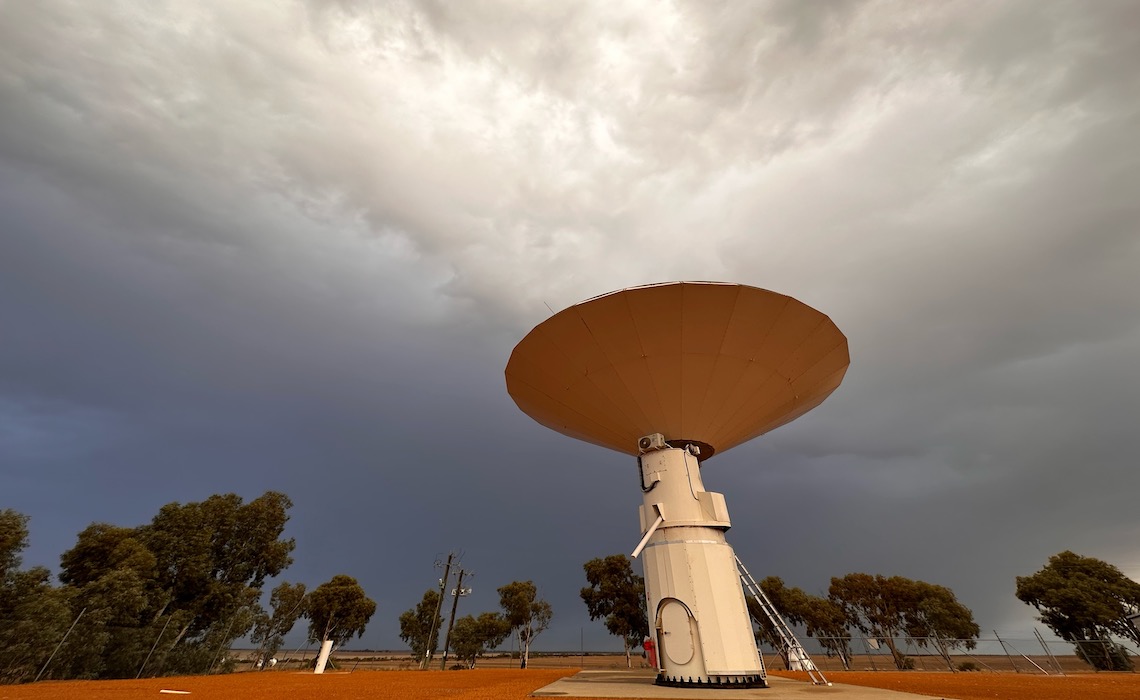
Recognising how vital VLBI data is for everyday life, Geoscience Australia, AuScope and the University of Tasmania together operate three separate VLBI stations at geodetic observatories across Australia, at Yarragadee, Western Australia; Katherine, Northern Territory; and Hobart, Tasmania. These observatories form part of the global network of geodetic observatories.
Geoscience Australia and the University of Tasmania also operate the Australian VLBI Correlation Centre at the National Computational Infrastructure at the Australian National University. Staff at the centre collaborate with partners from the International Association of Geodesy to convert VLBI data into the information needed by Global Navigation Satellite System (GNSS) operators.
Data transfer challenge
Currently, for global VLBI experiments, Australia is required to freight (by road and air) hard drives storing between 10 and 100 terabytes of raw VLBI data from geodetic observatories in remote parts of Australia to data centres in Washington, USA or Bonn, Germany.
This current method means one 24-hr session of VLBI observation data needs at least 14 days of lead-time until the results are released. This significant delay is viewed as a bottleneck for VLBI correlation and means Australia is not as efficient as other global centres.
The impact of this is that geodesists are not able to monitor changes in the Earth as effectively, limiting the improvement of the resilience and accuracy of PNT services.
A network for moving data faster
The partnership with AARNet will see new optic fibre connections and services delivered to the Katherine and Yarragadee Geodetic Observatories. The Geodetic Observatory at Hobart has already been provided with AARNet optic fibre connectivity and services via the University of Tasmania.
This upgrade will eliminate the need to freight raw VLBI data overseas as data will be transported over the network, greatly reducing the wait time between the observation, processing and release of Australian VLBI data. PNT service providers and users will be able to access the most up-to-date precise positioning information through almost real-time processing, which will lead to faster developments of more accurate and reliable PNT services.
This story was first published on the AARNet website
Image credit: The 12 m Patriot Antenna used for Very Long Baseline Interferometry observations at the Yarragadee Geodetic Observatory. Credit: Robert Nugent Geoscience Australia Artist in Residence 2023.