Tlaloc, the Aztec rain god, was revered, and greatly feared, for his purported ability to send rain as well as bring drought and famine. He was believed to be able to hurl lightning, unleash devastating hurricanes and bring down rains that could destroy crops.
Today a modern-day GPS network with the same name will help forecast the same elements to prevent calamity rather than wreaking it.
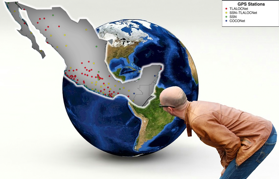
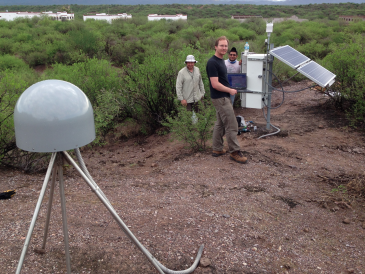
The “Long-Term Terrestrial and Atmospheric Transboundary Observatory and Collaboration Network” (TLALOC-Net) is a network of Global Positioning System (GPS) and meteorological stations in Mexico, developed for the study of atmospheric and solid earth processes. This network spans most of the country, with a strong focus in southern and western Mexico.
The observations made through TLALOC-Net will allow better analysis of the energy accumulation and release processes throughout the Mexican subduction zone, the Gulf of California fault system and surface deformation processes, as well as provide estimates of water vapor that will contribute to the advancement of knowledge of atmospheric processes in Mexico.
Created in Cooperation
TLALOC-Net was inspired and created after scientists, Latin American, North American and European National Research and Education Networks (NREN) representatives, the National Science Foundation (NFS) and CONACyT met in Puerto Vallarta to investigate ways to analyze the fundamentals, uses and implementation of a state-of-the-art atmospheric and GPS network in Mexico. Their goal was to enable applied climate research, weather forecasting and studying the physical processes that control earthquakes and volcanoes. The result was the establishment of the first consortium of Mexican researchers and institutions that would openly share data, work in unison to defend and facilitate GPS-based science in Mexico and strive to develop the human and technical capacity of the country for cutting-edge research and hazard prediction. This consortium spans six Mexican universities and research institutes and five from the United States. TLALOC-Net promises to be a landmark in the promotion of natural science research in Mexico through the open exchange of new data types and the collaborative work of a new generation of Mexican and American scientists who will use the system as its main research tool.

CUDI, Mexico’s NREN and TLALOC-Net
The University of Guadalajara (UDG), home to two consortium members, the Center for Strategic Studies for Development (CEED) and the General Coordination of Information Technologies (CGTI), is an interconnection node of the CUDI communication backbone and hosts the TLALOC-Net project servers. CUDI is responsible for administering, promoting and developing the National Research and Education Network (NREN) of Mexico, and increasing synergy among its members by serving CUDI users and the general public with access to the TLALOC-Net project data. CUDI regularly performs tests at national and international levels to deliver new services that facilitate solutions and stimulate innovation in diverse areas of R&D. CUDI is collaborating to obtain connectivity in the places where the TLALOV-Net continuous monitoring stations are located. For instance, CUDI can contribute to the project’s continuity by collaborating with UDG to manage the Jalisco State Government network to extend the reach of TLALOC-Net. Jalisco is located within a seismic zone.
A Safer World
TLALOC-Net data uses GPS technology to provide precise millimetric positioning, which can be assimilated in numerical models such as the coupling level between plates, volcanic deformation, the short-term prediction of extreme weather events and convective system analysis. This is indispensable information for the study, monitoring and forecasting of severe geological and atmospheric processes. For the Earth sciences, TLALOC-Net improves detailed ongoing studies on earthquake behavior, tectonics of subduction zones and subsidence of terrain. The Mexican Jalisco-Chiapas subduction zone is ideal for detailed studies on the seismic surveying cycle of subduction, which includes co-seismic break, post-seismic failure rebound and viscoelastic rebound, episodic slip and elastic deformation. TLALOC-Net provides additional margins in the movement of Pacific North America plates and continental transform faults and also provides a large number of observations on the seismic cycle of subduction.

“Establishing a relationship between different working groups in Latin America and CGPS networks like TLALOC-Net contributes to the advancement of the monitoring of hazards to be studied, as well as observable geophysical processes from where we take advantage to establish an initial backbone of geophysical observations, as multidisciplinary research platforms focused on translating scientific advances into social benefits.”
For more information (in Spanish) please visit: